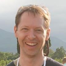
Peder Nelson
Peder Nelson
With a background in environmental education, biological sciences, and land management, I use remote sensing and geographic information systems to create maps and data that show people what is happening on planet Earth, particularly changes that can be seen from space. In my current work, I am developing an automated visualization and analysis tool for mapping changes in glacier extent using annual 1984 to 2014 satellite imagery. The overarching broader impact of this project is to create a novel way for glaciologists, climatologists, educators, and students to understand how and where Earth’s glaciers have changed over this period. I have significantly contributed to several research projects related to understanding forest and land cover changes using Landsat satellite imagery across the United States, eastern Europe, Russia, Mongolia, and Kazakhstan. In addition I have created several education lessons based around this research (http://onrep.forestry.oregonstate.edu/authentic-science-activities).
Projects